


Accessories
Package Included
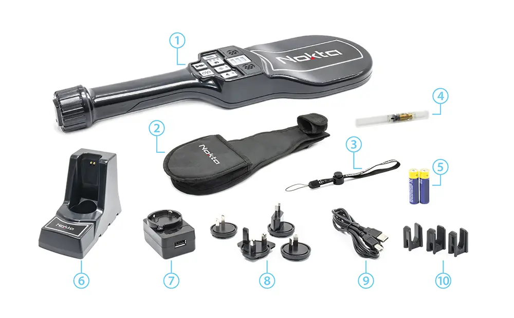
1 - NMS30 Security Detector
2 - Waist Carrying Case
3 - Wrist Strap
4 - Calibration Test Piece
5 - 2xAA Rechargeable Batteries
6 - NMS20/30 Charging Station
7 - Universal Charger
8 - Universal Charger Pins
9 - USB Charging Cable
10 - NMS20/30 Charging Station Connection Pins (3 pcs)


There are no reviews yet.