Groundtech GR-4 3D Ground Scanner


Please login to leave a review:
Loading reviews...
Store & Products
Warranty & Training
Shipping & Payment



- EUR: € 2.503,48
- EUR: € 581,17
- EUR: € 4.023,45
- EUR: € 1.877,61
Coupon Opportunity!
The Groundtech GR-4 3D Ground Scanner measures underground anomalies with MFS-2 dual-sensor technology and shows results on its built-in screen. This ground scanner supports 3D, live and pinpointer scanning, with optional G-Portal mobile analysis. The manufacturer's stated 15-metre limit for this 3D ground scanner depends on soil and target conditions.
Groundtech GR-4 3D Ground Scanner
2100.00 USD
The Groundtech GR-4 3D Ground Scanner records underground anomalies for immediate review on its built-in screen. This ground scanner can also send survey data to the G-Portal app for more detailed analysis.
Groundtech states that its GR-4 3D Ground Scanner can reach up to 15 metres with 3D scanning, depending on target size and soil. A ground scanner image is an interpreted survey result, not proof of a buried object’s material or exact depth.
3D Ground Scanner Key Features
| Brand: | Groundtech |
|---|---|
| Max Depth: | 15 Meters |
| Search Systems: | 3D Ground Scan, Live Scan, Pinpointer |
| Made In: | Turkey (Conrad Engineering) |
| Tech: | Smart 3D CN-D Sensor |
| Warranty: | 2 Years |
| Shipping: | Free Worldwide Express |
3D Ground Scanner Underground Survey
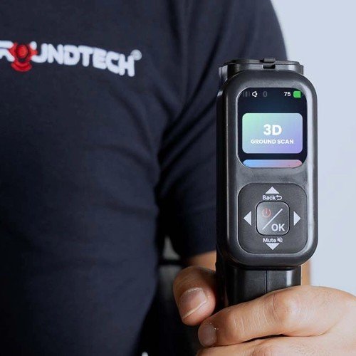
The Groundtech GR-4 3D Ground Scanner is a compact sensor-based system for surveying larger buried features. This ground scanner has a built-in colour display, so basic scans can be reviewed without connecting a phone or tablet.
The Groundtech GR-4 3D Ground Scanner uses MFS-2 dual-sensor technology to measure ground response. Its 3D ground scanner views help distinguish patterns associated with metal objects or voids, while field confirmation remains necessary before digging.


3D Ground Scanner Operating Modes
The Groundtech GR-4 3D Ground Scanner offers 3D Ground Scanning, Live Scanning and Pinpointer functions. Choose a ground scanner mode that suits the survey, and compare repeat passes before treating an anomaly as a target.
The primary mode. It gathers data from the ground to create a full 3D graph. You can analyze the shape, depth, and size of underground objects up to 15 meters deep.
Walk and scan simultaneously without saving data. This mode provides a real-time 2D visualization, showing red for metal and blue for voids. Perfect for rapid scouting.
Once you find a potential target, use Pinpointer mode to locate its exact center. This high-sensitivity digital mode helps you define the precise spot to dig.
3D Ground Scanner Technical Specifications
3D Ground Scanner Applications
- Void Detection: Finding caves, tunnels, cellars, and tombs.
- Deep Treasure: Locating large chests and statues.
- Infrastructure: Mapping pipes and underground structures.
- Archaeology: Non-invasive site surveying.
3D Ground Scanner Package Contents
- GR-4 3D Ground Scanner Main Unit (Telescopic)
- 5 Volt Charging Adapter & Cable
- Hard Transport Case
- Wrist Strap & User Manual
- Warranty Certificate (2 Years)
3D Ground Scanner Software and App
3D Ground Scanner G-Portal Analysis
The Groundtech GR-4 3D Ground Scanner connects to the G-Portal app for expanded visual analysis. The ground scanner can still display modes, settings and initial results on its own screen during fieldwork.
Maintenance for the Groundtech GR-4 3D Ground Scanner starts with checking the manufacturer’s instructions and app version. Keep this ground scanner charged and inspect its sensor and connection before a survey.
Bluetooth 4.2 BLE links the Groundtech GR-4 3D Ground Scanner with a compatible phone or tablet for app functions. This ground scanner also operates independently for on-device viewing, so the mobile device is optional for basic scanning.
3D Ground Scanner Frequently Asked Questions
Q: Does the Groundtech GR-4 3D Ground Scanner require specialist experience to use its ground scanner modes?
A: The Groundtech GR-4 3D Ground Scanner has an on-device display and clear scanning options. A ground scanner operator should still follow the manual, record survey conditions and verify uncertain anomalies with repeat measurements.
Q: Is the Groundtech GR-4 3D Ground Scanner suitable for finding individual surface coins like a metal detector?
A: The Groundtech GR-4 3D Ground Scanner focuses on subsurface scanning and larger anomalies. For shallow coin searches, the GR-4 Dual 3D Ground Scanner and Metal Detector adds a dedicated pulse induction metal detector mode; choose according to the target and site.
Q: Must a tablet be included for the Groundtech GR-4 3D Ground Scanner to show ground scanner results?
A: The Groundtech GR-4 3D Ground Scanner has a built-in colour screen for standalone operation. A compatible Android or iOS device provides G-Portal app analysis, while the ground scanner package contents should be checked with the seller before purchase.
3D Ground Scanner Video Demonstration

Technical Specifications
| SKU | Conrad-GR4 |
|---|