OKM Gepard GPR
Please login to leave a review:
Loading reviews...
Store & Products
Warranty & Training
Shipping & Payment




- USD: 2.800$
- USD: 2.100$
- USD: 650$
- USD: 4.500$
- USD: 27.990$
Coupon Opportunity!
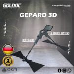
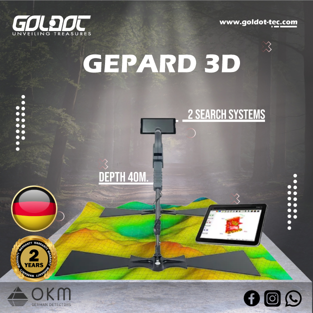
Explore beneath the surface with the OKM Gepard GPR 3D, a portable ground penetrating radar for investigating buried structures, utilities and cavities.
- 60–300 MHz GPR technology with adjustable telescopic antennas.
- 2D radargrams and 3D visualization for detailed survey analysis.
- Android touchscreen operation with USB-C measurement transfer.
- Applications: archaeology, geotechnical engineering, forensics and utility surveys.
- Reported depth up to 40 m, depending on ground conditions and target characteristics—not guaranteed.
- 2-year warranty.
OKM Gepard GPR 3D
Ground Penetrating Radar · 2D & 3D visualization
Explore underground structures, map subsurface anomalies, and analyze your survey in 2D and 3D.
See Beyond the Surface
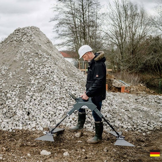
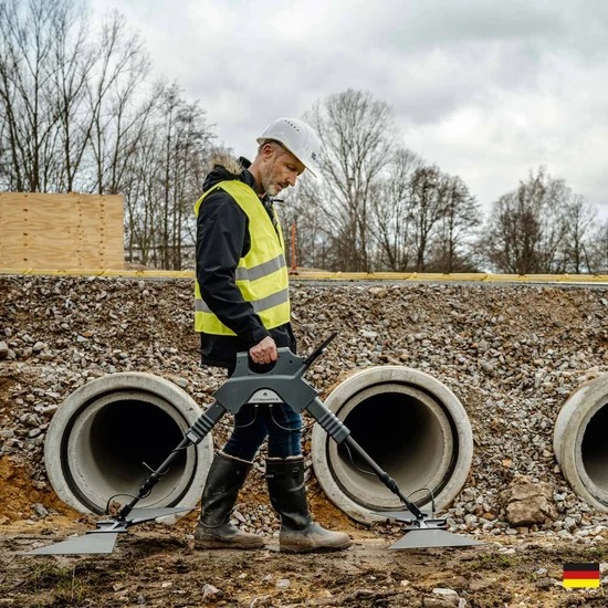
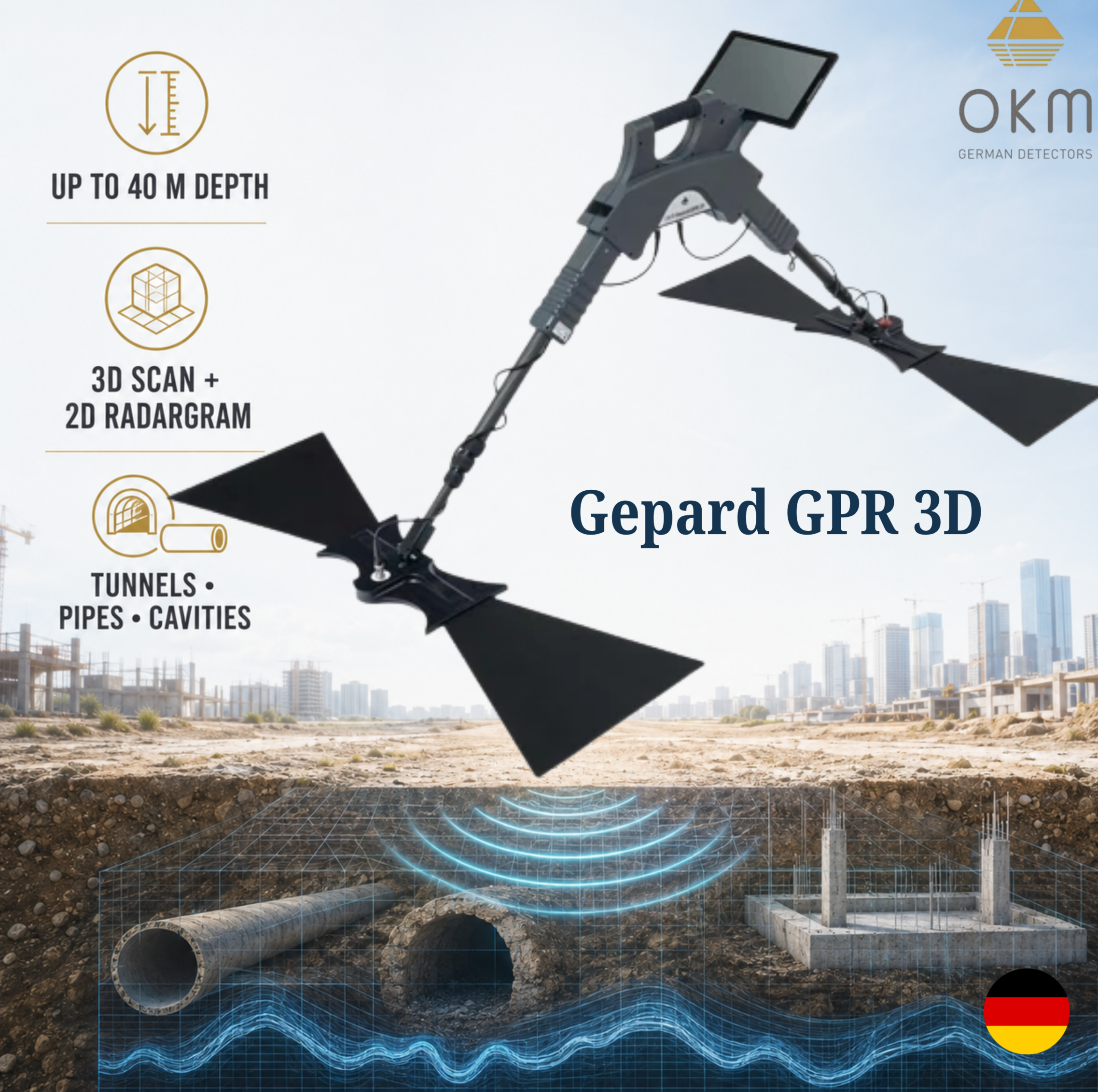
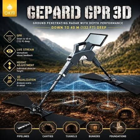
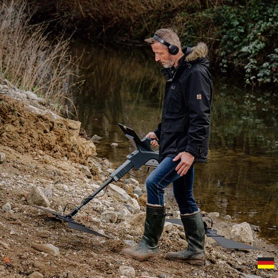
The OKM Gepard GPR 3D is a portable ground penetrating radar for surveying buried structures and subsurface anomalies. It sends radar signals into the ground and records their reflections, helping investigate pipelines, cavities, conduits, tunnels, bunkers and foundations.
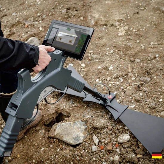
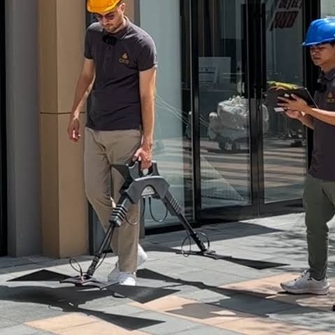
Its omnidirectional, unshielded transmission system works across 60–300 MHz with adjustable telescopic antennas. A single operator can collect measurements using the Android tablet, then review radargrams and 3D scan views.
Depth performance: OKM reports customer finds down to 40 m (approximately 131 ft). This is a reported maximum, not a guaranteed detection depth. Achievable results depend on soil conditions, target size and contrast, antenna settings and survey interpretation.
Key Features
| Brand | OKM |
|---|---|
| Manufacturing origin | Germany |
| Technology | Ground Penetrating Radar (GPR); omnidirectional unshielded transmission |
| Operating modes | 3D Ground Scan; 2D Radargram |
| Visualization | 2D visualization, 3D visualization and live data display |
| Frequency range | 60–300 MHz |
| Reported maximum depth | Up to 40 m (approximately 131 ft), subject to survey conditions |
| Controls and ergonomics | Android tablet color touchscreen; height-adjustable telescopic shafts |
| Data and analysis | USB-C data transfer; stored measurements; GPS/Google Maps integration; notes and filtering |
| Audio | Acoustic feedback, headphones and speaker |
| Power | Rechargeable battery; approximately 4 hours operating time |
| Languages | 11 app languages, including Arabic and English |
| Warranty | 2 years |
| Water protection | Not waterproof; IP20 |
Product Gallery
Explore the Gepard GPR 3D in 360°
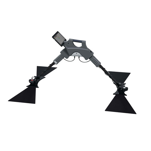
Drag horizontally or use the buttons to rotate the detector.
Advanced Survey & Analysis
Adjustable radar surveying
Telescopic antennas support the 60–300 MHz transmission range. Automatic adjustments help adapt the survey to soil types; select an appropriate depth resolution before collecting data.
Android measurement workflow
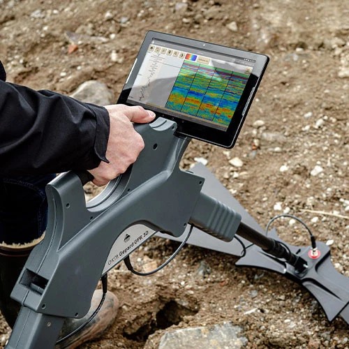
Measurements transfer to the Android tablet through a USB-C cable and appear on screen. Store scan data, add notes and associate positions using the app’s GPS or Google Maps options.
2D radargrams and 3D views
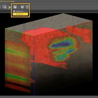
Visualizer 3D Studio offers 2D radargram and volumetric 3D render views for GPR measurements. Review the same survey from different perspectives to investigate significant anomalies.
Soil settings, smoothing and threshold
In Visualizer 3D Studio, soil-type settings and smoothing help refine visualization. Adjust the volumetric threshold to control visible scan values and focus analysis on relevant areas.
Objects & Structures to Investigate
GPR reveals contrasts and anomalies in the subsurface. The following are manufacturer-listed applications; a scan alone does not establish an object’s identity or composition.
Structures and reinforcement
Underground walls, basements, foundations and concrete reinforcement.
Voids and buried spaces
Cavities, graves, backfilled wells, galleries, trenches and dugouts.
Utilities and services
Pipelines, conduits, cable routes, septic tanks, distribution boxes and drainage pipes.
Large underground spaces
Tunnels, bunkers, shelters and chambers.
Buried objects
Treasure chests, statues and caches where their size, material contrast and ground conditions produce a detectable response.
Water-related investigations
Water levels, underground rivers and aquifer-related features are listed applications. Interpretation requires appropriate site conditions and corroboration; results do not establish water quality or yield.
Professional Use Cases
Geotechnical engineering
Investigate subsurface structures and anomalies as part of a broader site assessment.
Archaeology
Survey buried walls, foundations, cavities and potential burial structures before planning further investigation.
Forensics
Investigate subsurface anomalies and possible concealed spaces or disturbed ground.
Public services
Survey utility routes, drainage-related features and buried infrastructure.
Cavity detection
Explore potential voids, underground rooms and tunnels.
OKM Search Services
The manufacturer lists professional search services among its applications.
Practical Survey Tips
Choose appropriate settings
Use the manufacturer’s recommended antenna and depth-resolution setup for the survey area.
Collect consistent measurements
Plan repeatable survey passes, maintain consistent positioning and record relevant site observations.
Review anomalies from multiple views
Compare radargrams with 3D visualization and repeat measurements where clarification is needed.
Keep the equipment dry
The control unit, telescopic shafts and antennas are not waterproof. The protective transport case does not make the equipment suitable for underwater use.
Technical Specifications
| Dimensions (H × W × D) | 450 × 260 × 130 mm |
|---|---|
| Weight | Approximately 1.6 kg |
| Maximum input voltage/current | 8.4 V DC / 1.0 A |
| Operating time | Approximately 4 hours |
| Feedback | Acoustic and visual |
| Data transmission | USB-C cable |
| Transmission frequency range | 60–300 MHz |
| Timing/sampling adjustments | 4 levels |
| Complete cycle measurements | 9 per second |
| Operating temperature | −20°C to +55°C |
| Storage temperature | −25°C to +60°C |
| Air humidity | 5–70% |
| Waterproof | No |
| Protection rating | IP20 |
| Dimensions (H × W × D) | 70 × 60 × 590–1630 mm |
|---|---|
| Weight | 0.80 kg |
| Internal battery | 7.26 V / 2600 mAh |
| Operating temperature | −20°C to +55°C |
| Storage temperature | −25°C to +60°C |
| Air humidity | 5–70% |
| Waterproof | No |
| Protection rating | IP20 |
| Dimensions (H × W × D) | 1010 × 330 × 50 mm |
|---|---|
| Weight | 1.50 kg |
| Operating temperature | −20°C to +55°C |
| Storage temperature | −25°C to +60°C |
| Air humidity | 5–70% |
| Waterproof | No |
| Protection rating | IP20 |
App languages: Arabic (AR), Bulgarian (BG), German (DE), Greek (EL), English (EN), Spanish (ES), Persian (FA), French (FR), Italian (IT), Russian (RU) and Chinese (ZH).
Technical data are average values. Minor deviations during operation are possible. Component weights are listed individually and should not be interpreted as the total kit weight.
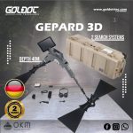
What’s in the Box?
| 1× | Control unit |
|---|---|
| 1× | Android tablet |
| 2× | Telescopic shaft |
| 1× | Sending antenna for Gepard GPR 3D |
| 1× | Receiving antenna for Gepard GPR 3D |
| 1× | USB flash drive with OKM Visualizer 3D Studio Professional Edition |
| 1× | Bluetooth headphones with charging cable |
| 1× | Charger with charging cable |
| 1× | Travel adapter set |
| 1× | Waterproof and shock-resistant protector case |
| 1× | Quick Start Guide |
| Optional | Pre-configured Windows notebook |
The actual scope of delivery may vary with technical developments and the ordered configuration. The Windows notebook is optional. Confirm the supplied tablet, software license and accessories for your order with Goldot.
Manufacturer & Support Information
Manufacturer: OKM, Germany. Warranty: 2 years; applicable terms and coverage apply.
Share This Device
Share the official device information with your survey team.
Frequently Asked Questions
Does it always detect down to 40 meters?
No. The 40 m figure is a manufacturer-reported maximum based on customer finds. Actual depth depends on ground conditions, target characteristics, antenna settings and interpretation.
Is this a conventional metal detector?
It is a ground penetrating radar. It records radar reflections to investigate subsurface anomalies and structures, rather than providing conventional coin or nugget discrimination.
Does a 3D scan identify gold or other materials?
A 3D view visualizes measurement values and anomalies. It does not, by itself, confirm that a target is gold or identify its exact composition.
Is the Gepard GPR 3D waterproof?
No. The listed control unit, shafts and triangular antennas are rated IP20 and are not waterproof. The waterproof protector case is for transport and protection.
How are measurements transferred?
The specified configuration transfers measurements to the Android tablet through a USB-C cable. Bluetooth headphones are an audio accessory, not the listed survey-data connection.
Is Visualizer 3D Studio included?
The listed scope includes a USB flash drive with Visualizer 3D Studio Professional Edition. Confirm the license and exact supplied configuration when ordering; a Windows notebook is optional.
What is the warranty?
The supplied warranty is 2 years, subject to the applicable warranty terms.
Technical Specifications
| SKU | Gepard-gpr-3D |
|---|---|
| Weight | 16 kg |