River G3 Systems
Please login to leave a review:
Loading reviews...
Store & Products
Warranty & Training
Shipping & Payment




- EUR: € 2.492,56
- EUR: € 1.869,42
- EUR: € 578,63
- EUR: € 4.005,90
Coupon Opportunity!
The RIVER G3 systems is provided with a 3D imaging system to allow the prospector to see more accurate details of the presence of underground water layers as a three-dimensional image as well as to show the water analysis results. Type of water: with a sign indicating the best place to dig, which contains the largest amount of water. The depth of water detected measured by meters. A pie chart showing the ratio of density, rocks, and salinity.
RIVER G 3 SYSTEMS
Special Offer: $7,000.00 USD
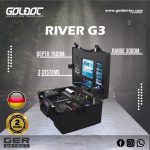
3 INTEGRATED SYSTEMS | 3D Imaging, Geophysical, Long Range
“The ultimate solution for farmers and water exploration companies worldwide”
A Totally New Device for Water Exploration
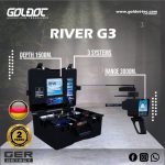
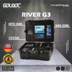
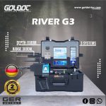
The River G is a first-of-its-kind device worldwide, characterized by three distinct systems for the detection of groundwater, artesian wells, and borewells. It offers an incredible detection range, reaching a depth of 1500 meters underground and a front range of up to 3000 meters.
Designed for farmers, agricultural investors, and major exploration companies, the River G provides highly accurate data on water type (fresh, salty, very salty) and soil composition. With the ability to choose your specific continent and country, it adapts to any terrain—rocky, natural, mixed, mineralized, clay, or sandy.
Three Advanced Search Systems
- 1. 3D Imaging System
Provides a high-quality three-dimensional image of water and rock locations. It displays accurate details of underground water layers, water density, rock percentage, and salinity. It even suggests the best place to dig for the largest amount of water. - 2. Geophysical Search System
One of the most powerful systems for fast and accurate results. It provides all necessary data about underground water, including depth, density, and specific type (Fresh vs. Salty). - 3. Long Range System
Ideal for vast areas. Use the high-resolution touch screen to select your soil type and range (500m to 3000m). When a target is captured, the device guides you directly to the water source, confining the location to within 1 square meter.
What’s in the Box?
- ✔ River G Main Control Unit
- ✔ Geophysical Probe (810 mm)
- ✔ Long-Range Probe (340 mm)
- ✔ Li-ion Rechargeable Battery (54Wh)
- ✔ Charger & Power Adapter
- ✔ Long-Range System Unit
- ✔ Device Case (Systems Bag)
- ✔ Accessories Bag
Complete Technical Specifications
| Geophysical System & Main Unit | |
| Audio Output | Piezo buzzer Ø:12mm – H:9.8mm, 85db at 12v/10cm, 4.5±0.5 kHz |
|---|---|
| Display (LCD) | Touch screen full-colour 800 x 600 px (8 inch) – 165mm x 124 mm |
| Frequency | 2.91 kHz |
| Data Processing Speed | 11 MHz |
| Operating Temp Range | 0 °C to 60 °C |
| Operating Humidity | Up to 95 % non-condensing |
| Storage Temp Range | -20 °C to 70 °C |
| Storage Humidity | Up to 98 % Relative Humidity |
| Operating Time | 8 – 12 Hours (54Wh Battery) |
| Waterproof Rating | Not waterproof (Weatherproof only) |
| Wireless Module | Bluetooth HC-06 2.4GHz Radio transceiver |
| Probes & Dimensions | |
| Cables Length | 20 m |
| Geophysical Probe | Length: 810 mm |
| Long-Range Probe | Length: 340 mm |
| Long Range System | |
| Display (LCD) | Full-colour 98mm x 57mm / 480×270 px |
| Device Length | 170 mm (Unit only) / 310mm (with sensor) |
| Frequency | Max 500 KHz |
| Data Processing Speed | 8 MHz |
| Operating Time | 10 Hours (27 Wh Battery) |
| Compass Module | GY-282 |
| Weight | 500 g |
| Power & Battery Specifications | |
| Battery Type | Li-ion Rechargeable (External) |
| Main Battery Output | 10.8 VDC / 54 Wh |
| LR Battery Output | 10.8 VDC / 27 Wh |
| Charger Input | 90 → 250 VAC 50→60 Hz |
| Charger Output | 12.6 VDC / 1000 mA |
| Weights & Packaging | |
| Total Weight | Systems Bag: 7500 g | Accessories Bag: 9200 g |
| Bag Weight (Empty) | 3.5 kg each |
| Bag Dimensions | 53cm x 40cm x 22.8 cm (Both bags) |
Share this Device
Frequently Asked Questions
Q: What is the maximum depth of the River G?
A: The River G can detect underground water sources up to a depth of 1500 meters.
Q: Does it determine the type of water?
A: Yes, it provides precise details on whether the water is Fresh, Salty, or Very Salty, along with rock density.
Q: How many languages does it support?
A: The device supports 6 languages: German, English, French, Spanish, Italian, and Arabic.

Technical Specifications
| SKU | Ger-river-g3 |
|---|