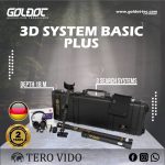
Tero Vido 3D System Basic Plus Ground Scanner


Please login to leave a review:
Loading reviews...
Store & Products
Warranty & Training
Shipping & Payment



- USD: 2.800$
- USD: 2.100$
- USD: 650$
- USD: 4.500$
- USD: 13.000$
Coupon Opportunity!
The Tero Vido 3D System Basic Plus Ground Scanner combines vertical and horizontal probes with tablet-based 3D software. Ground scanning depth depends on target size, soil and survey technique; confirm the supplied package and any subsurface finding independently.
Tero Vido 3D System Basic Plus Ground Scanner
The Tero Vido 3D System Basic Plus Ground Scanner includes an 85 cm vertical probe for subsurface measurement. This ground scanning package also includes a 50 cm horizontal probe, according to the manufacturer.
The Tero Vido 3D System Basic Plus Ground Scanner presents subsurface anomalies as software images. Ground scanning can support investigation of possible metal targets and voids, but images alone do not confirm what lies underground.
Ground Scanner Technology
The Tero Vido 3D System Basic Plus Ground Scanner records survey data for analysis on its supplied tablet. This ground scanning device is designed to assess metallic and possible cavity anomalies; independent checks remain necessary before excavation.
The Tero Vido 3D System Basic Plus Ground Scanner is portable and uses separate probes for different survey layouts. The manufacturer lists a depth of up to 21 metres, while this listing previously mentioned 18 metres; ground scanning depth varies with target size, soil and technique and neither figure is guaranteed at a given site.
Ground Scanner Survey Advantages
- 1. Real-Time 3D Analysis
Scan results are displayed in real-time on the included tablet screen. High-resolution graphics provide one of the most detailed analyses on the market, determining depth and size instantly. - 2. Metal Discrimination
The software allows you to filter and distinguish between ferromagnetic metals (iron) and non-ferromagnetic precious metals (gold, silver, copper). - 3. Void Detection
Ideally suited for locating underground cavities. Whether it is a tunnel, tomb, warehouse, or hidden room, the Tero Vido Basic reveals structures up to 18 meters deep. - 4. All-Terrain Capability
Works in sandy, rocky, or clayey soil. Small metal anomalies in highly mineralized soils can be filtered out using the advanced software settings.
Ground Scanner Package
- ✔ Vertical Sensor (85 cm)
- ✔ Tablet with Pre-installed Software
- ✔ USB Data Exchange Dongle
- ✔ Headphones (Bluetooth/WiFi)
- ✔ Charging Cable & Adapter (12V/220V)
- ✔ Flexible Carrying Case (Screen Protection)
- ✔ Sensor Carrying Bag
- ✔ Manual & Quick Start Guide
Ground Scanner Specifications
Ground Scanner Technical Details
| 1. Sensor Type | Vertical, 85 cm (0.8 kg) |
|---|---|
| 2. Max Depth | Up to 18 Meters |
| 3. Battery | Rechargeable LiPo 800 mAh (15h Runtime) |
| 4. IP Protection | IP 54 (Waterproof) |
| 5. Processor | 16 MHz 8-bit RISC |
| 6. Data Transmission | 2.4 GHz ISM Band / Bluetooth |
| 7. Charging | 1h (Main Adapter) / 4h (Car Charger) |
| 8. Software Languages | En, De, Fr, Ru, Ar, Tr, Es, Gr, Ro, Bg |
| 9. Operating Temp | -10° to + 50°C |
| 10. Warranty | 2 Years |
Share This Device
Ground Scanner Questions
Q: Does the Tero Vido 3D System Basic Plus Ground Scanner include a tablet for ground scanning?
A: The manufacturer lists a tablet with Tero Vido 3D software in the Tero Vido 3D System Basic Plus Ground Scanner package. Verify the dealer package before purchase, since ground scanning accessories can vary between offers.
Q: What probes does the Tero Vido 3D System Basic Plus Ground Scanner use for ground scanning?
A: The manufacturer lists an 85 cm vertical probe and a 50 cm horizontal probe for the Tero Vido 3D System Basic Plus Ground Scanner. Ground scanning results from either probe require careful interpretation and, where practical, independent confirmation.
Q: Can the Tero Vido 3D System Basic Plus Ground Scanner distinguish gold from iron during ground scanning?
A: Tero Vido describes software analysis of magnetic and nonmagnetic metal responses for the Tero Vido 3D System Basic Plus Ground Scanner. Ground scanning images can guide follow-up checks, but they do not identify a particular buried metal with certainty.

Technical Specifications
| SKU | N/A |
|---|