

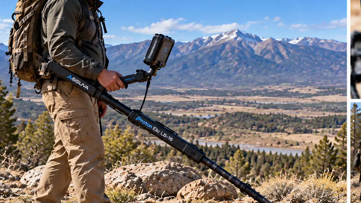
The Assuva Proton Elic LB-16 should be purchased around a defined survey project, not around one advertised depth or range figure. Therefore, US buyers should start by explaining the site, expected anomaly, survey area, team experience, and data-analysis requirements.
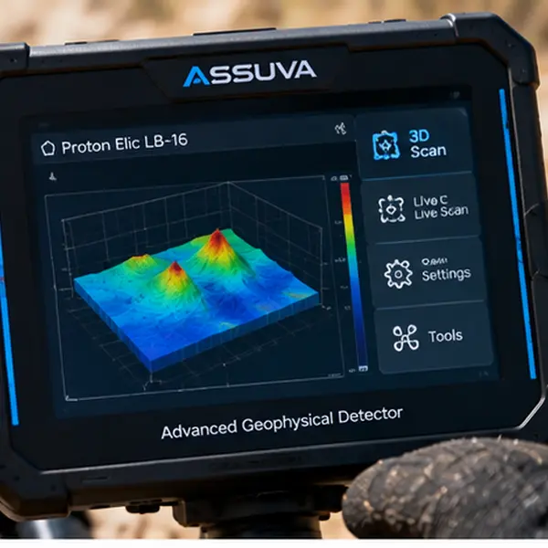
The LB-16 is not a conventional coil-based detector. Instead, it combines a 64-pixel thermal system with sixteen JEO PHASE magnetic sensors. The platform also transfers collected sensor information through Bluetooth for software-based analysis.
That architecture creates a different workflow from ordinary coin, relic, or nugget detecting. First, the operator needs a structured survey area. Next, the team must collect data consistently. Afterwards, suspicious responses need repeat measurements and careful interpretation.
For this reason, the buying decision should include training and software requirements. Package contents also deserve close attention because Goldot-Tec lists the IF Doppler Radar as an optional module rather than a guaranteed part of every configuration.
A Texas project may require different preparation from a Colorado site. Likewise, a small private assessment area creates different equipment needs from a larger professional survey.
Therefore, tell Goldot-Tec what your project actually involves before ordering.
You can review the current Assuva Proton Elic LB-16 system details and then request a configuration based on the real survey objective.
Planning an LB-16 Project in the United States
A successful LB-16 purchase begins with a project brief.
You do not need to know what lies underground before ordering. However, you should know what question you want the system to investigate.
For example, one project may focus on a suspected metallic anomaly. Another may involve a possible void or underground structure.
The survey method changes with the objective. Therefore, a generic package recommendation can create unnecessary equipment or missing components.
Define the Project Type
Start by choosing the main investigation category.
The project may involve:
Metallic underground anomalies.
Possible cavities.
Underground structures.
Geological differences.
Site assessment.
Professional exploration.
Controlled treasure-related investigation.
The LB-16 can provide sensor information that supports these investigations. However, it should not automatically label every anomaly as a valuable target.
Therefore, define what evidence would justify further investigation before the first scan.
Estimate the Survey Area
Project size affects workflow.
A small site can support tightly controlled repeat measurements. Meanwhile, a large area requires stronger location records and more disciplined data management.
Before requesting a package, estimate:
The site dimensions.
The number of survey zones.
The likely number of operating days.
The number of operators.
The available computer equipment.
Transport requirements.
The expected environmental interference.
This information helps Goldot-Tec understand the scale of the project.
Confirm Site Access First
Equipment selection should come after legal access.
Therefore, confirm that you have authorization to survey the intended location.
Private land may require owner permission. Other sites can involve different restrictions.
Do not assume that purchasing professional underground equipment creates permission to scan or excavate.
Instead, settle access requirements before scheduling the project.
Texas Survey Project Planning
Texas provides a useful hypothetical example.
Imagine a project on an authorized private site where the owner wants to investigate a defined underground anomaly.
The correct approach would not begin by randomly walking across the entire property.
Instead, the team should create a repeatable survey plan.
Establish a Texas Survey Grid
First, define the project boundaries.
Then divide the site into manageable zones.
Record fixed landmarks whenever possible.
For example, a team could label sections as Area A, Area B, and Area C.
This simple structure improves data organization.
If a suspicious response appears later, the operator can return to the same location.
Record Surface Conditions
Surface information matters because environmental factors can influence interpretation.
Therefore, document obvious site features.
Useful notes may include:
Metal fences.
Vehicles.
Machinery.
Reinforced concrete.
Utility infrastructure.
Visible scrap metal.
Recently disturbed ground.
Wet soil.
Large rocks.
These notes can explain unexpected readings later.
Repeat Before Escalating the Project
One unusual reading should not automatically trigger a major excavation decision.
Instead, record the location.
Then repeat the measurement.
Afterwards, approach the zone again using the same method.
If appropriate, perform another pass from a different direction.
Consistent location is more useful than one dramatic display.
Therefore, project planning should prioritize repeatability.
Colorado Site Assessment
Colorado creates another useful scenario.
Again, this example does not claim that one LB-16 configuration performs identically across the state.
Mountainous terrain, weather, soil conditions, access, and nearby metal can vary dramatically.
Therefore, the project should follow the real site rather than the state name.
Plan for Terrain and Transport
A Colorado assessment may require more equipment movement than a flat site.
For that reason, buyers should consider how the LB-16, protective case, computer equipment, charging hardware, and optional modules will reach the survey area.
A smaller team may prioritize a simpler package.
Meanwhile, a longer professional project may justify backup power and additional field support.
Transport planning should happen before the order.
Consider Weather and Surface Change
Weather can alter the working environment.
For example, recent moisture can change surface conditions.
Likewise, snow, runoff, or disturbed soil can complicate comparisons between different survey days.
Therefore, record the date and visible conditions for each important measurement.
This information gives the software results more context.
Use the Same Survey Method
Consistency matters even more on uneven terrain.
The operator should avoid unnecessary changes in device orientation.
Movement speed should also remain controlled.
In addition, repeated surveys should use similar reference points.
The goal is not to make every reading identical.
Instead, the goal is to determine whether a suspicious anomaly remains linked to the same physical location.
What the LB-16 Actually Measures
Understanding the sensor architecture helps buyers avoid unrealistic expectations.
The system combines thermal and magnetic measurements.
Therefore, the operator receives indirect information that requires interpretation.
64-Pixel Thermal System
Assuva documents a 64-pixel thermal system arranged in four rows and sixteen columns.
The stated viewing angle is 60 degrees.
Its purpose is to measure thermal differences within the area being observed.
For the buyer, this means the thermal system contributes another layer of information.
However, it does not photograph an underground room or metal object.
Instead, the operator evaluates measured thermal differences.
Sixteen JEO PHASE Magnetic Sensors
The magnetic section contains sixteen sensing points.
Each sensor measures DC magnetic-field strength along its orientation.
As a result, the system can collect information from multiple points at the same time.
This can help identify magnetic anomalies.
However, a magnetic anomaly is not automatically a confirmed valuable metal target.
Nearby infrastructure may also influence measurements.
Therefore, site preparation remains important.
Bluetooth Data Transfer
The LB-16 transfers sensor information through Bluetooth to a computer software environment.
That feature makes the computer part of the project workflow.
Therefore, buyers should confirm software requirements before ordering.
Ask which computer environment the supplied software supports.
Also confirm whether installation or activation steps apply.
Do not arrive at the project site before testing the software connection.
Data Collection Workflow
The LB-16 becomes more useful when the survey produces organized data.
Therefore, teams should plan the measurement process before field work begins.
Create a Site Record
Give every project a clear name.
Then divide the location into zones.
For each zone, record basic information.
A practical record can include:
Project name.
Area number.
Survey date.
Starting location.
Search direction.
Selected sensing method.
Surface conditions.
Known nearby metal.
Operator name.
Initial response.
Repeat-test result.
This process turns isolated readings into a survey history.
Establish a Reference Area
Before investigating the most suspicious zone, collect information from a reference area when practical.
The reference gives the operator a baseline.
Therefore, unexpected behavior becomes easier to recognize.
The goal is not to prove that the reference ground contains nothing.
Instead, it provides a comparison point.
Keep Movement Consistent
Operators should avoid random changes in survey technique.
Maintain a controlled direction.
Likewise, keep device orientation consistent.
Movement speed should remain as stable as practical.
This improves comparison between passes.
Mark Interesting Responses
When a response deserves further attention, record the location immediately.
Do not rely on memory.
Use physical markers or another project-safe location method when permitted.
Then repeat the measurement.
A repeatable anomaly has more investigative value than an isolated response.
Result Interpretation Needs
The LB-16 does not eliminate the need for human interpretation.
In fact, interpretation becomes one of the main reasons training matters.
Treat Visual Output as Evidence, Not Proof
Color or LED feedback can help the operator identify areas that deserve attention.
However, the display should not become a final identification by itself.
A metallic indication does not confirm gold.
Likewise, a cavity-related indication does not automatically confirm an underground room.
Instead, treat the response as evidence to investigate.
Compare Multiple Measurements
Repeated measurements provide more context.
For example, an operator may record an anomaly during the first pass.
Next, the same location can be surveyed again.
Afterwards, the team can compare both results.
If the physical location changes significantly, the evidence may be weaker.
If the anomaly remains linked to the same zone, further verification may make more sense.
Separate Collection From Interpretation
One useful team workflow divides responsibilities.
The field operator focuses on consistent measurements.
Meanwhile, another team member can organize notes and software files.
Later, the results can be reviewed together.
This reduces the temptation to change the survey method because one interesting image appears on the screen.
Training, Software and Optional Modules
Professional ownership should include more than learning which button activates each mode.
The operator needs to understand how the data was produced.
Therefore, training should cover both operation and interpretation.
Training Before the First Major Project
Ask Goldot-Tec what training format is available.
Useful training topics may include:
Thermal-system operation.
Magnetic-sensor workflow.
Site preparation.
Environmental interference.
Bluetooth connection.
Software data transfer.
Survey consistency.
Repeat testing.
Interpretation limits.
Project documentation.
A short interface demonstration alone may not prepare a team for professional survey work.
Therefore, buyers should ask whether the training covers realistic project workflows.
Software Preparation
Test the computer setup before traveling.
First, confirm the compatible software environment.
Next, test Bluetooth pairing.
Then verify that data reaches the software correctly.
Finally, confirm where project files will be stored.
This step prevents technical delays on site.
Goldot-Tec also provides a dedicated LB-16 setup guide for buyers who need a more structured preparation workflow.
Optional IF Doppler Radar
The IF Doppler Radar should be treated separately from the LB-16’s core thermal and magnetic system.
Goldot-Tec lists the radar as an optional add-on.
Its documented purpose relates to detecting living beings behind certain barriers.
Therefore, do not assume the radar forms part of the standard underground survey package.
Also, do not confuse it with Ground Penetrating Radar.
These technologies serve different purposes.
If your project actually requires the IF Doppler Radar, ask Goldot-Tec to include it explicitly in the written configuration.
Otherwise, keep it outside the package.
Included Equipment vs Optional Equipment
Package clarity can prevent one of the biggest buying mistakes.
A buyer may compare two LB-16 offers that appear similar but include different hardware.
Therefore, compare written component lists rather than product photos.
Core Package Checks
The Goldot-Tec product documentation lists the main LB-16 unit with its thermal and magnetic architecture.
The current product information also references items such as:
Rechargeable power.
Charging equipment.
Bluetooth capability.
Protective carrying equipment.
User documentation.
Warranty materials.
However, the final Goldot-Tec package should still be confirmed before payment.
Do not assume every promotional presentation represents the exact current order.
Optional Equipment Checks
Optional hardware should appear separately.
The IF Doppler Radar is the clearest example.
If it is included, ask for that detail in writing.
If it is not included, do not compare the package against another offer that contains the module.
Software Access
Software is part of the operational workflow.
Therefore, confirm:
Which software is supplied.
Which computer system it requires.
Whether activation is needed.
Whether updates are available.
How project files are stored.
What training covers the software.
These questions are as important as checking the physical sensors.
Environmental Interference Planning
Magnetic surveying can become harder when the site contains large metal objects.
Therefore, site inspection should happen before serious measurements.
Identify Nearby Metal
Potential interference can include:
Cars.
Fences.
Machinery.
Large steel structures.
Reinforced concrete.
Utility equipment.
Surface scrap.
Metal storage containers.
Record these objects before scanning.
Do not invent one universal safe distance.
Instead, follow manufacturer or training guidance for the actual project.
Document Ground Disturbance
Recently excavated or filled ground may differ from nearby areas.
Moisture can also change between survey days.
Therefore, write down visible changes.
This information can become useful during software interpretation.
Check the Reference Zone Again
If the system begins behaving differently during the project, return to the reference area.
Then compare the response.
This can help identify whether the change follows the suspected target zone or reflects broader environmental conditions.
Team and Equipment Planning
A professional project can involve more than one operator.
Therefore, package planning should reflect the team.
Single-Operator Projects
A small project may use one trained operator.
In that case, the buyer should prioritize manageable transport and a simple documentation process.
A laptop or supported computer also needs a safe field setup.
Two-Person Survey Team
Two operators can divide responsibilities.
One person can handle the LB-16.
Meanwhile, another can record positions, surface conditions, and software information.
This structure may improve consistency.
Larger Projects
A larger site may require additional planning.
Consider:
Backup charging options.
Computer protection.
Additional field storage.
Location marking.
Data backup.
Transport cases.
Project documentation.
However, do not buy equipment only because the package looks more professional.
Every item should support a real project need.
When Another System May Be Better
The LB-16 should solve a specific underground-investigation problem.
Therefore, another technology may sometimes fit better.
Simple Coin or Relic Recovery
A conventional metal detector usually provides a faster workflow for individual shallow metallic targets.
Using an LB-16 for ordinary park coin hunting would add unnecessary complexity.
Natural-Gold Prospecting
A specialist PI or gold detector can provide a more appropriate coil-based workflow for nugget hunting.
Again, choose the technology around the target.
Structured 3D Ground Scanning
Another project may prioritize a conventional 3D sensor architecture.
In that situation, compare the LB-16’s thermal and magnetic approach against other imaging systems.
Ground Penetrating Radar
GPR uses another measurement method.
Therefore, the LB-16 should not be purchased as though it were a conventional GPR unit.
If the project requires geological layer profiling or another radar-based workflow, confirm the correct technology first.
Evidence Verification Before Major Decisions
Professional survey results should support further investigation rather than force a conclusion.
Therefore, important anomalies deserve confirmation.
Repeat With the Same System
Start by repeating the LB-16 measurement.
This checks whether the anomaly remains connected to the same location.
Use Another Appropriate Technology
Depending on the suspected target, a second method may provide useful evidence.
For example, another project may use a conventional metal detector, a PI detector, a professional scanner, or another appropriate survey system.
The second device does not need to produce identical data.
Instead, it should contribute another measurement.
Review the Complete Evidence
Before a major next step, review:
LB-16 measurements.
Repeat-test consistency.
Surface conditions.
Known interference.
Software results.
Second-method results where available.
Project notes.
This creates a stronger decision process than trusting one screen image.
US Purchase Configuration Checklist
Before requesting your LB-16 package, prepare a short project brief.
Project Information
State the main investigation goal.
Describe the expected site size.
Explain whether metallic anomalies, voids, or structures are the main concern.
Mention the expected number of survey days.
Operator Information
Tell Goldot-Tec how many people will use the system.
Also explain their previous scanning experience.
This helps determine training needs.
Software Information
Confirm the computer you plan to use.
Ask about supported software requirements.
Likewise, confirm Bluetooth data transfer before field work.
Package Information
Request written confirmation of:
LB-16 main unit.
Thermal sensor system.
Sixteen magnetic sensors.
Bluetooth components.
Battery.
Charging equipment.
Protective case.
Documentation.
Warranty terms.
Software access requirements.
Training format.
Optional modules.
US availability.
Delivery options for your state.
This checklist gives the buyer a clear basis for comparing configurations.
Use Goldot-Tec Support Before Field Deployment
Professional equipment creates more value when the operator understands the workflow.
Therefore, do not wait until the first survey to ask configuration questions.
Send Project Requirements Before Ordering
Tell Goldot-Tec whether the hypothetical project resembles a Texas property assessment, a Colorado terrain survey, or another authorized US site.
Then explain the intended anomaly type.
Also mention known environmental challenges.
This information improves package planning.
Ask for Workflow Support
Buyers can review Goldot-Tec’s LB-16 operating guide before the first serious survey.
Use it alongside any training provided with the package.
Confirm Current Availability
Finally, verify availability close to the purchase date.
Package components can change.
Therefore, request current written confirmation instead of relying on an old screenshot or previous quote.
Frequently Asked Questions
What type of project is suitable for the Assuva Proton Elic LB-16?
The Assuva Proton Elic LB-16 makes the most sense for structured underground-investigation projects involving metallic anomalies, possible cavities, underground structures, or other subsurface differences. However, the system should not replace a simple conventional detector when the project only involves individual shallow coins or jewelry. Define the survey question first, then confirm whether the LB-16’s thermal and magnetic architecture matches it.
What training format should I request for an LB-16 project?
Ask for training that covers more than basic controls. The operator should understand site preparation, thermal readings, magnetic responses, Bluetooth transfer, software workflow, environmental interference, repeat measurements, location records, and interpretation limits. In addition, ask whether the training includes practical examples of uncertain or inconsistent readings. This can be more useful than a demonstration built around one obvious target.
How should I choose the correct Proton Elic LB-16 configuration?
Start with the project type, site size, team experience, software requirements, and intended data workflow. Then confirm the main LB-16 unit, battery, charging equipment, Bluetooth components, protective case, documentation, warranty, software access, and training. Treat the IF Doppler Radar as an optional module unless Goldot-Tec explicitly includes it in your written package. Finally, confirm availability and delivery options for your US state.
Request Your Assuva Proton Elic LB-16 US Package
The Assuva Proton Elic LB-16 should be selected as a project system rather than as a generic detector.
Its 64-pixel thermal system provides one type of measurement.
Meanwhile, sixteen JEO PHASE magnetic sensors provide another.
Bluetooth then transfers collected information into a software-based analysis workflow.
Therefore, the real purchasing value comes from combining the hardware with disciplined data collection and interpretation.
A Texas project may prioritize repeatable measurements around a defined private survey area.
A Colorado project may place more emphasis on terrain, transport, weather, and consistent survey positioning.
Neither example guarantees a result.
Instead, they demonstrate why the project should shape the configuration.
Before ordering, define the objective.
Next, document the site requirements.
Then, confirm the software environment and training format.
Afterwards, separate included equipment from optional modules.
Finally, request the exact package in writing.
Buying in the United States? Ask Goldot-Tec about availability and delivery options for your state. Send the team your project type, survey-area needs, operator experience, software requirements, and training questions. Then request an Assuva Proton Elic LB-16 configuration designed around your actual field workflow.