

Modern underground imaging technologies allow operators to study subsurface anomalies before excavation. These methods include 3D ground scanning, ground-penetrating radar, smart target imaging, electromagnetic induction, electrical resistivity, and data-logged pulse detection.
Each technology measures a different physical property. Some respond primarily to metal, while others reveal changes in conductivity, resistivity, dielectric properties, or underground structure.
Understanding these differences prevents buyers from expecting one system to identify every buried object, cavity, tunnel, mineral deposit, or archaeological feature.
What This Keyword Means for Buyers
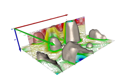
An underground image is not always a photograph. In most systems, software converts measured data into:
- Color-coded 3D anomalies.
- Two-dimensional radargrams.
- Conductivity maps.
- Resistivity sections.
- Target-shape estimates.
- Depth profiles.
- Plan views.
- Time-slice visualizations.
The output depends on the technology, survey design, soil, calibration, and interpretation.
Top Detector Models to Consider
| System | Technology | Suitable Application |
|---|---|---|
| OKM eXp 7000 Pro Plus | 3D Ground Scan and VLF | Treasure, minerals, tunnels, and anomalies |
| OKM Gepard GPR 3D | Ground-penetrating radar | Foundations, tunnels, pipelines, and cavities |
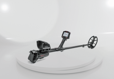
| Nokta Invenio Pro | Smart imaging | Shape, depth, dimensions, and metal analysis |
| Nokta Deephunter 3D | Deep detection and cavity mode | Mixed treasure and void searches |
| Lorenz Deepmax Z2 with data logging | Pulse detection and mapped surveys | Large metallic objects |
These systems should be treated as examples of different categories rather than direct equivalents.
Key Features and Technologies
3D Ground Scanning
A 3D ground scanner records measurements across a rectangular field using parallel scan lines.
Software then displays anomalies according to:
- Signal strength.
- Shape.
- Position.
- Depth estimate.
- Soil contrast.
- Scan consistency.
The OKM eXp 7000 includes 3D Ground Scan, Live Scan, Mineral Scan, and Tunnel Scan alongside VLF functions.
This technology is useful for professional treasure investigations, mineralized zones, possible cavities, and underground structures.
Ground-Penetrating Radar
GPR transmits radio-wave pulses into the ground and records reflected signals caused by changes in underground electromagnetic properties.
The U.S. EPA describes GPR as an electromagnetic geophysical method that transmits radio-wave pulses into the ground to study the subsurface.
GPR can support investigations involving:
- Foundations.
- Pipes.
- Tunnels.
- Voids.
- Stratigraphic layers.
- Archaeological structures.
- Utility mapping.
Its performance depends strongly on soil conductivity, moisture, antenna frequency, and target contrast.
Smart Target Imaging
The Invenio Pro tracks the search coil’s movement and combines positional information with target signals.
The system can display estimated target shape, dimensions, position, depth, and possible ground anomalies.
Smart imaging is most useful when the target is metallic and the operator wants more information than a conventional tone or target number.
Electromagnetic Induction
Electromagnetic induction methods detect changes in underground conductivity without necessarily requiring direct contact with the ground.
EPA technical guidance explains that frequency-domain electromagnetic methods induce alternating current within subsurface conductors and analyze differences between transmitted and returning signals.
This technology is used for conductivity mapping, metal detection, environmental studies, and locating underground variations.
Electrical Resistivity
Electrical resistivity surveys inject current into the ground through electrodes and measure voltage differences.
The results can identify lateral and vertical changes in subsurface resistivity.
Resistivity is useful for:
- Cavities.
- Groundwater studies.
- Geological layers.
- Moisture changes.
- Foundations.
- Archaeological structures.
Unlike non-contact metal detectors, resistivity requires electrodes to make electrical contact with the soil.
Pulse Detection and Data Logging
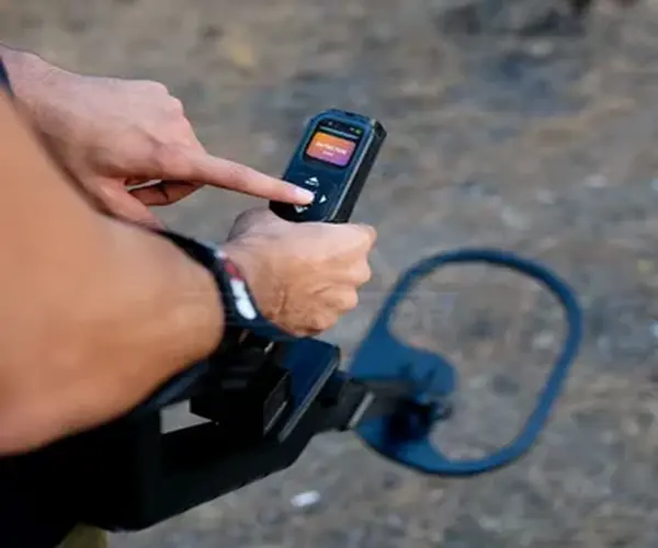
A pulse detector such as the Deepmax Z2 focuses primarily on conductive metallic targets.
When connected to compatible data-logging tools, repeated measurements can be mapped across an area. This does not create the same type of image as GPR, but it can show the distribution and relative strength of metallic responses.
Depth Performance and Accuracy
No underground imaging technology has one universal depth.
Depth depends on:
| Factor | Effect |
|---|---|
| Soil conductivity | Can weaken radar and electromagnetic signals |
| Moisture | Changes dielectric and electrical properties |
| Target size | Large anomalies are easier to identify |
| Frequency | Lower radar frequencies generally penetrate deeper with less detail |
| Survey spacing | Tighter spacing can improve resolution |
| Target contrast | Stronger contrast improves visibility |
| Surface interference | Can hide weaker anomalies |
| Software processing | Influences clarity and interpretation |
| Operator technique | Controls data quality |
High depth and high resolution usually involve a trade-off. A system optimized for large deep structures may not clearly show tiny objects.
Best Uses: Gold, Treasure, Coins, Beach
Gold and Minerals
Mineral Scan modes can help identify responses associated with natural mineralization, but they do not replace geological knowledge, sampling, or laboratory confirmation.
Buried Treasure
Smart imaging and 3D scanners can help estimate target position, dimensions, and anomaly shape before excavation.
Tunnels and Cavities
GPR, 3D ground scanning, and resistivity are more appropriate than ordinary coin detectors for non-metallic voids.
Coins and Jewelry
A conventional multi-frequency detector is usually more practical than an underground scanner.
Beaches
Waterproof multi-frequency or pulse detectors are normally more suitable for beach targets. Professional imaging systems are only justified for specific structural investigations.
Price Range and Value Comparison
| Technology | General Investment Level | Training Requirement |
|---|---|---|
| Conventional detector | Entry to premium | Low to moderate |
| Smart imaging | High professional | High |
| 3D ground scanner | Professional to ultra-professional | High |
| GPR | High professional | High |
| Electrical resistivity | Professional survey equipment | High |
Value should be measured by whether the method answers the project’s question, not by the number of colors shown on the screen.
Pros and Cons of Leading Options
| Technology | Advantages | Limitations |
|---|---|---|
| 3D Ground Scan | Portable and visual | Sensitive to scan technique |
| GPR | Structural subsurface imaging | Soil conductivity can reduce performance |
| Smart imaging | Target dimensions and location | Mainly depends on detectable target signals |
| Electromagnetic induction | Rapid non-contact conductivity mapping | Interpretation can be complex |
| Electrical resistivity | Strong for geological and cavity contrasts | Requires electrode contact |
| Pulse data logging | Useful for large metal surveys | Does not map every non-metallic structure |
How to Choose the Right Device
Choose according to the project:
- Use GPR for structural layers, foundations, pipes, and tunnels.
- Use a 3D ground scanner for portable anomaly surveys.
- Use smart imaging for metallic target shape and dimensions.
- Use pulse detection for large buried metals.
- Use resistivity for geological, moisture, and cavity contrasts.
- Use a conventional detector for coins, jewelry, and routine metal searches.
Review Best 3D Ground Scanner – GR-4 Dual vs Others and Ultimate Gold Scanner GR-4 Dual vs OKM EXP 7000 when comparing commercial scanning platforms.
Common Buying Mistakes to Avoid
- Treating every color anomaly as metal.
- Expecting software to identify gold automatically.
- Ignoring soil conductivity.
- Using wide scan spacing for small targets.
- Relying on one survey direction.
- Skipping control scans.
- Confusing GPR with a conventional detector.
- Excavating before checking the anomaly with another method.
Final Recommendation and FAQs
There is no universal ground imaging detector for every project.
Use a 3D scanner for portable anomaly surveys, GPR for structural subsurface imaging, smart imaging for target dimensions, pulse systems for large metals, and electrical resistivity for geological or cavity contrasts.
Relevant commercial comparisons include OKM EXP 7000 Pro Plus vs GR-4 Dual 3d ground scanner, Groundtech A2 vs Klayzer Max 2D 3d metal detector, and Find the Best Deep Gold Detectors for Sale.
What are underground imaging technologies?
They are methods that measure physical differences beneath the surface and convert them into maps, sections, radargrams, or 3D visualizations.
Is a 3D scanner the same as GPR?
No. The systems may collect and process data differently. GPR records electromagnetic reflections, while other scanners may analyze magnetic or sensor-based anomalies.
Can underground imaging identify gold?
It can identify metallic or mineralized anomalies, but positive gold identification normally requires additional evidence or testing.
Which technology is best for tunnels?
GPR, 3D ground scanning, and electrical resistivity may all be useful, depending on soil and tunnel dimensions.
Why do two scans produce different results?
Differences in path, spacing, speed, direction, soil conditions, calibration, and interference can change the data.