Visualize the Subsurface
Welcome to the Imaging System Online Shop at Goldot Technologies, your gateway to the most advanced geophysical exploration tools available today. In the high-stakes fields of professional treasure hunting, archaeological excavation, and geological surveying, the paradigm has shifted. Relying solely on the audio feedback of traditional metal detectors—the simple beeps and tones that indicate the mere presence of conductivity—is no longer sufficient for serious operations. Today, success is defined by the ability to "see" beneath the earth's surface before a single shovel touches the ground. Our curated selection of professional imaging systems provides precisely that advantage: a detailed, visual reconstruction of buried anomalies in real-time.
The transition from audio detection to 3D ground imaging is akin to moving from a cane to an X-ray machine. Traditional Very Low Frequency (VLF) detectors can tell you *that* something is buried, but they struggle to tell you *what* it is, especially at significant depths or in complex soil conditions. The imaging systems offered here at Goldot utilize multi-sensor arrays to gather comprehensive data about the subsurface environment. This data is processed to reveal the approximate shape, size, orientation, and, most critically, the precise depth of a target. This capability fundamentally changes field operations. It allows prospectors to distinguish between a worthless ferrous junk target, like a rusted pipe, and a valuable non-ferrous target, like a gold cache or ancient bronze statuette, without wasting hours or days on unnecessary digging. It turns blind speculation into informed strategy, ensuring that every excavation effort is calculated and efficient.
Why choose imaging over sound?
Imaging systems use advanced sensors—including Magnetometers, Gradiometers, and Ground Penetrating Radar (GPR)—to measure subsurface anomalies and create a 3D digital map. This eliminates the guesswork associated with audio-only detectors, allowing for high-accuracy discrimination between gold, silver, precious metals, cavities, and common iron waste.
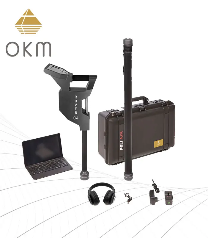
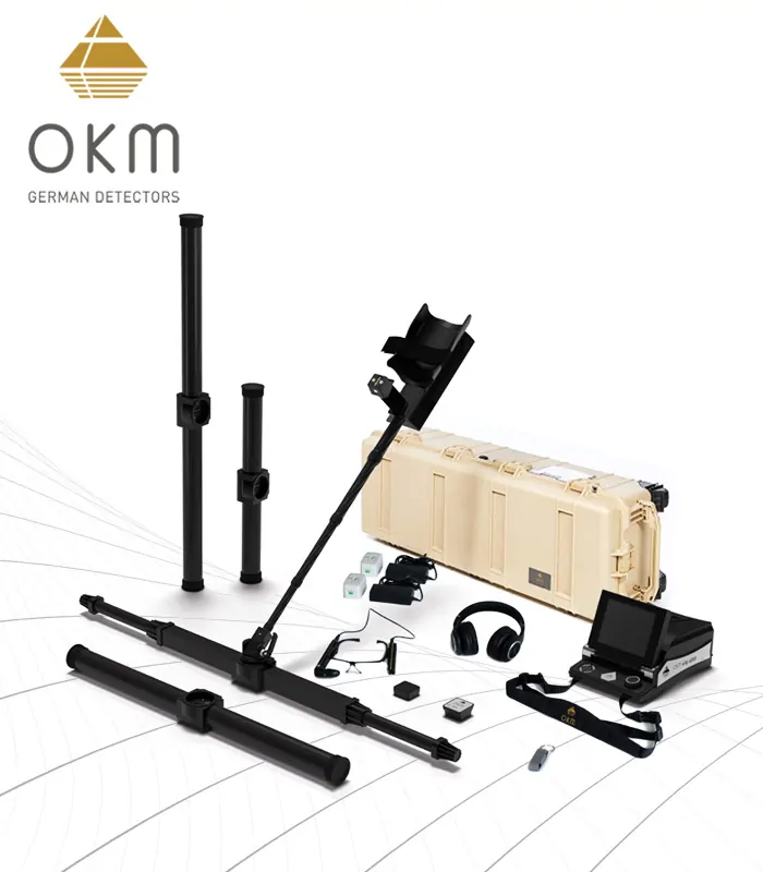
German Engineering & Precision
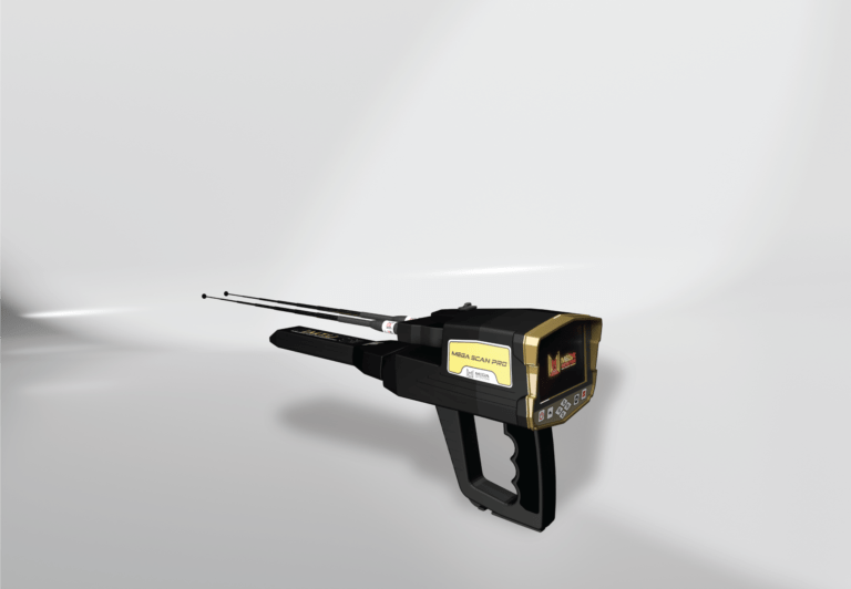
In the realm of high-technology sensors and geophysical instruments, German engineering stands as the global benchmark for precision, durability, and innovation. Our online shop proudly specializes in the world's most trusted imaging brands originating from this tradition of excellence, most notably Ajax Detection Technology and Mega Detection. These manufacturers are not simply assembling electronics; they are pioneering the science of subsurface detection. When you invest in a German-engineered system through Goldot, you are investing in equipment designed to perform in the most unforgiving environments on Earth, from the highly mineralized red soils of the Australian outback to the conductive wet sands of coastal areas and the rugged, rocky terrain of mountain ranges.
A critical advantage of these top-tier systems is their ability to handle "ground noise." Cheaper detectors are often overwhelmed by the natural mineralization found in the earth, leading to false signals and erratic performance. The systems we carry utilize advanced Automatic Ground Balance (AGB) algorithms and sophisticated pulse induction technologies to filter out the magnetic interference of the soil itself. This ensures that the data returned in your 3D scan remains clear, accurate, and interpretable. Furthermore, the depth capabilities of these professional units far exceed hobbyist capabilities. Whether you are an archaeologist mapping ancient foundations buried meters below millennia of sediment, or a professional treasure seeker hunting for deep hoards, our imaging systems provide the necessary penetration power—reaching verified depths of up to 30, 40, and even 50 meters depending on target size and soil composition.
The Science Behind the Scan
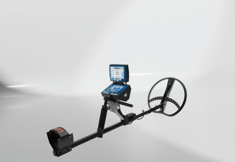
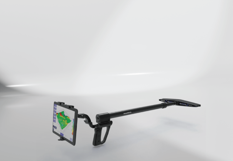
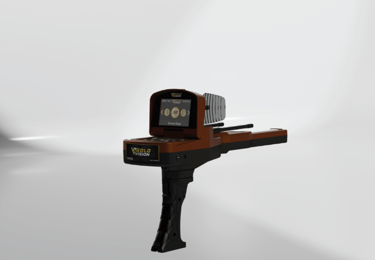
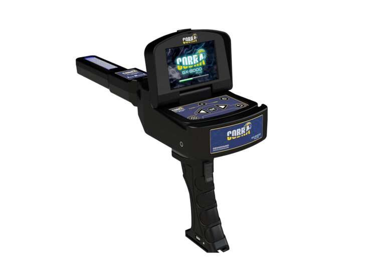
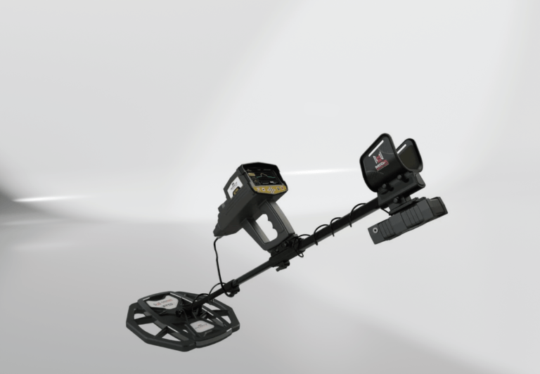
Understanding how these powerful devices create a visual image from beneath the ground is key to maximizing their potential. Unlike standard detectors that use a single coil to transmit and receive electromagnetic fields, modern imaging systems often employ a "Multi-Sensor" approach. This can include super-sensitive gradiometers that detect minute changes in the Earth's local magnetic field caused by buried ferrous objects or fired pottery/bricks. Simultaneously, electromagnetic induction systems send pulses deep into the ground, analyzing the decay rate of the eddy currents induced in conductive targets to determine metal type. Ground Penetrating Radar (GPR) adds another layer, sending high-frequency radio waves into the ground and measuring the reflected signals to map structures and layers.
The raw data collected by these sensors is useless without interpretation. This is where the powerful analysis software, such as the renowned Visualizer 3D or the integrated Android-based systems found on Ajax devices, comes into play. As you walk your scan grid, the system compiles the sensor readings. The software then translates these mathematical values into a color-coded 3D graphical representation. Typically, red and orange hues indicate non-ferrous metals like gold or silver; blue colors represent voids, tunnels, or caves (areas of low density); and green usually signifies normal ground soil. By rotating this 3D model on your screen, you can analyze the target from all angles, measuring its dimensions and pinpointing its exact location before you ever pick up a shovel.
Beyond Treasure Hunting: Diverse Applications
While the allure of undiscovered gold is a primary driver for many of our clients, the imaging systems available in our shop are versatile industrial tools used across various professional sectors. Their ability to non-invasively map the subsurface makes them invaluable in fields where digging blindly is dangerous or cost-prohibitive.
Archaeology and Anthropology: Modern archaeologists rely heavily on ground imaging to survey potential sites without disturbing sacred ground or damaging fragile artifacts. Our systems allow teams to map the outlines of buried foundations, identify tombs or burial chambers, and locate ancient hearths or industrial areas, allowing for precisely targeted test pits rather than broad, destructive excavation.
Geology and Mining: Small-scale mining operations utilize these devices to track mineral veins, identify fault lines, and locate deposits of placer gold in dried riverbeds. The ability to differentiate mineral density helps geologists understand subsurface structures without expensive core drilling.
Construction and Utility Locating: Before breaking ground on a new project, it is vital to know what lies beneath. Industrial-grade imaging systems are used to locate deep-buried PVC or metal pipes, map underground storage tanks, identify unexploded ordnance (UXO) in former conflict zones, and detect dangerous voids or sinkholes under proposed building sites.
The Goldot Promise: Support and Expertise
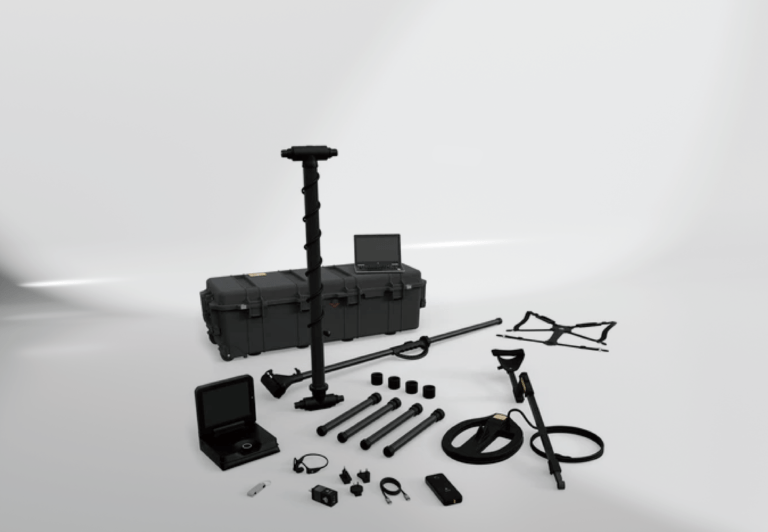
Purchasing a professional 3D imaging system is a significant investment in your capabilities. At Goldot Technologies, we believe that the sale is just the beginning of our relationship. Owning the best technology in the world is only half the battle; knowing how to interpret the complex data it provides is the other half. We do not just ship boxes; we provide comprehensive solutions.
As an authorized distributor for premier German and international brands, we guarantee that every device sold in our online shop is authentic, factory-calibrated, and backed by a full manufacturer’s warranty. We are acutely aware of the counterfeit market and ensure our clients never face the risk of purchasing inferior clone devices. More importantly, Goldot provides ongoing technical support and training resources. Learning to distinguish a geological anomaly from a man-made treasure in a 3D graph takes practice. Our team of experts is available to guide you through the learning curve, helping you understand scan techniques, software analysis filters, and data interpretation. When you choose the Imaging System Online Shop at Goldot, you are gaining a partner dedicated to your success in the field.